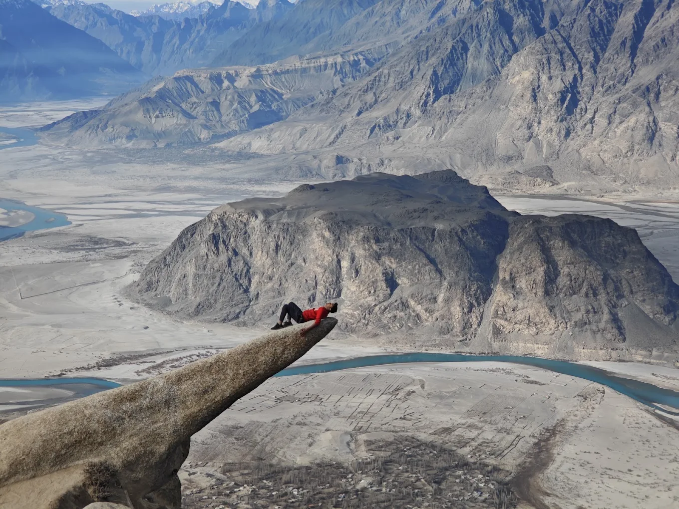
Marsur Rock — Pakistan’s Trolltunga — sits high above Hussainabad village, a short drive from Skardu city in Gilgit-Baltistan. Getting there is a real part of the adventure: a scenic road journey followed by a steep but rewarding hike. Here is exactly how to reach Marsur Rock, step by step.
Where is Marsur Rock?
Marsur Rock lies above Hussainabad, roughly 9 to 11 km from Skardu city along the road toward Shigar and Khaplu. The ledge sits at about 3,737 metres (12,260 feet) above sea level, with the trail starting near 3,000 metres — so most of the altitude is gained on foot.
Step 1: Getting to Skardu
By air: Airlines fly direct from Islamabad to Skardu in about an hour, weather permitting — the fastest and most scenic option. By road: Skardu is connected to Islamabad via the Karakoram Highway through Gilgit and Chilas, a journey of roughly 18 to 22 hours, often broken with an overnight stop in Chilas or Gilgit.
Step 2: Skardu to Hussainabad by road
From Skardu city, the drive to Hussainabad takes about 20 to 30 minutes and passes terraced Balti villages with early views of the Indus River. You have three main options:
- Private taxi — the most convenient; expect roughly PKR 300 to 500 one way, agreed before you set off.
- Shared van — the budget choice at around PKR 100 to 200 per person, from Skardu’s main stop toward Hussainabad.
- Jeep or 4×4 — best if you want to cover the rough off-road stretch up toward the trailhead rather than starting the walk lower down.
Tell your driver you are heading for Marsur Rock so they drop you at the right point in Hussainabad.
Step 3: The trailhead
From Hussainabad, a zigzag track climbs to the start of the trail at the upper edge of the village, marked by a small metal bridge over a mountain stream. This is where the hike begins. Note that mobile signal disappears here for several hours, so let someone know your plans first.
Step 4: The hike to the rock
Cross the bridge and follow the path alongside the stream through green meadows. After about an hour you reach a fork — skip the gentler first trail and take the steeper second path on the left, which leads directly toward the rock. From there it is a sustained, rocky climb until the ledge appears. The trek is roughly 5.7 km round trip, taking about 2 to 3 hours up and 4 to 6 hours in total including rest and photos at the top.
Tips for the journey
- Wear sturdy hiking shoes — the terrain is rocky and uneven.
- Carry plenty of water and snacks, as there are no facilities on the trail.
- Start early to catch the best light and avoid the midday heat.
- Consider a local guide, as the trail forks can be confusing and it supports the Hussainabad community.
- Check the mountain forecast, as weather at altitude changes fast.
Best time to make the trip
The road and trail are best from May to October. For a full breakdown, see our guide to the best time to visit Skardu.
Frequently asked questions
How far is Marsur Rock from Skardu? Marsur Rock is about 9 to 11 km from Skardu city, roughly a 20 to 30 minute drive to Hussainabad, followed by the hike.
How long does it take to reach Marsur Rock? Plan around 2 hours for travel and 4 to 6 hours for the round-trip hike — comfortably a full day trip from Skardu.
Can I visit Marsur Rock without a guide? Yes, many hikers go unguided, but a local guide is recommended for first-timers because the trail forks and there is no phone signal for hours.
Is the road to Hussainabad paved? The main road is largely paved, but the final stretch toward the trailhead is rough, so a jeep or 4×4 is handy for that section.
Plan your Marsur Rock trip
Ready to go? Read our full Marsur Rock tour guide and 10 things to know before you hike it, browse the best places to visit in Skardu, or message us on WhatsApp to start planning.
Leave a Reply